
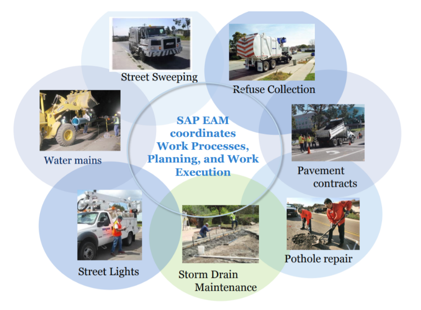
In 2018, the City of San Diego rolled out Phase 1 of a SAP-based software solution to improve the City’s management of infrastructure assets. The IAM San Diego Project, a citywide strategic initiative to develop and implement an integrated SAP-based software solution, is now being used for asset-based planning; capital asset management, including the CIP, Multiyear Capital Plan, and the City’s financial plan for the repair and/or construction of municipal infrastructure; predictive, proactive and corrective maintenance of asset-intensive operations; asset inspections; and condition assessments.
With the deployment of the IAM San Diego project, the City is more effectively managing capital assets to minimize the total cost of owning and operating them over their lifecycle, while also delivering the desired service levels to constituents.
GIS plays a unique role in asset management by applying technology that adds spatial data structures, geographic relationships, and location-based functions to traditional database tables. The City has streamlined operations by standardizing SAP as the work order system for operational asset maintenance and added spatial insight by incorporating Esri-based GIS technology. The IAM San Diego project required that asset information include the geographic location and required user tools that enable staff to identify and solve location-based questions. For example, viewing active work orders on a map allows staff to identify work clusters and more efficiently plan and schedule the City’s multi-year capital plan. GIS requirements were met by implementing desktop, web, and mobile GIS components.

The GIS components enable holistic planning and prioritization of infrastructure investments across departmental lines, along with a systematic approach to increase the long-term stability and sustainability of the city’s asset management program. It also enables an objective and transparent process to provide internal and external stakeholders with a clear view of what the city is investing in and why
For capital planning, an application named AMP GIS was developed to combine the asset maintenance history and prioritization information stored in the city’s SAP and Powerplan Asset Investment Optimization software with the city’s enterprise Esri-based GIS system. AMP GIS was implemented using Esri’s SAP HANA data connector and the ArcGIS Pro SDK. These combined technologies enable staff to visualize the distribution and extent of planned rehab and replacement jobs throughout the City.

AMP GIS Desktop is deployed to users as an ArcGIS Pro Add-In that consists of an interactive map and specialized tools for staff to group identified capital jobs based on the geographic proximity of other similar job types in order to stay within annual budget targets, spread over ten to fifteen year planning time frames. Using AMP GIS, City engineers are able to visualize the dispersion, clusters, and extent of the proposed work packages by project type and prioritization ranking. AMP GIS tools enable staff to directly insert a new proposed work event using the map and update an existing prioritization category or package grouping. Also, if a user modifies a priority value ranking or group assignment in the SAP client interface, the value will be re-read and re-drawn on the map when the map refreshes, making communication bi-directional.
This Desktop application was designed, developed and implemented during a 6 months time-frame, and went live this summer as the Public Utilities, Transportation and Storm Water, and Public Works Departments re-engineered their processes for identifying and prioritizing rehab and replacement projects.

While the AMP GIS ArcGIS Pro application is primarily used by engineers to schedule and group work packages by time and location, ArcGIS Portal is used as the underlying technology for a dashboard used by City planners and managers across multiple departments to review the proposed transportation, water, and wastewater capital work locations. The dashboard allows City staff to view where the planned work is, check for conflicts, and identify opportunities for coordination or schedule improvements. The dashboard provides maps and charts summarizing statistics such as total cost, total pipe lengths, and asset counts by work package type and location.
The IAM San Diego project is a critical step toward fully replacing disparate and outdated maintenance management systems previously used by Phase 1-participating departments. Using current EAM and GIS technology, the capital asset maintenance process has become more systematic and transparent across departments.
The City owns and maintains a large and complex network of infrastructure assets valued in the billions. The City has aging and deteriorating assets and a backlog of deferred maintenance and capital projects. The IAM System has helped to transform the City's approach from reactive to proactive maintenance based on lifecycle management minimizing lifecycle costs for assets and optimizing the City's limited funds. Tools that enable the City to better prioritize work allow the City to be more proactive.
For more information, contact Gerard Lonergan, contact information below.
Authors
Mr. Gerard Lonergan
EAM project manager
Dept of Information Technology, City of San Diego
glonergan@sandiego.gov
Ms. Jodi Luostarinen, MS, GISP, PMP
Founder and CEO of Quartic Solutions
jodi@quarticsolutions.com
(619) 602-7606
www.quarticsolutions.com
Ms. Luostarinen is the CEO of Quartic Solutions, a GIS consulting firm that delivers innovation and leadership to the field of Geographic Information Systems. Jodi possesses a unique blend of management, operational, and technical expertise in Enterprise GIS and Asset Management. With over 20 years of progressive experience in managing, designing, and developing GIS programs and applications, Jodi is the world's longest-standing certified GIS professional (GISCI GISP). She also won the 2018 first annual SAP and ESRI Hackathon held in Palm Springs this spring.
References:
Infrastructure at the City of San Diego
Citywide at the City of San Diego
SAP for Utilities: I am San Diego, an Enterprise Framework for Sustainable Asset Management
City of San Diego: Enterprise Asset Management Project
